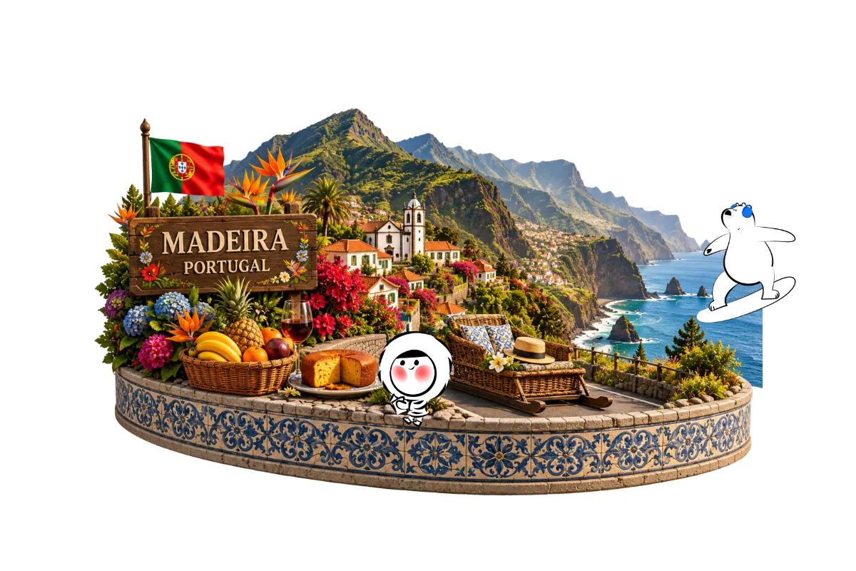
Madeira is a Portuguese archipelago in the North Atlantic Ocean, southwest of mainland Portugal and west of Morocco. Its main island, Madeira, belongs to Portugal’s Autonomous Region of Madeira, whose capital is Funchal.
Although Madeira is geographically closer to Africa than mainland Portugal, it is part of Portugal and the European Union. The archipelago lies approximately 1,000 kilometers from mainland Europe, 500 kilometers from the African coast, and 450 kilometers north of the Canary Islands.
Known for its volcanic mountains, dramatic coastline, and mild subtropical climate, Madeira is a popular destination for hiking, nature, and scenic island holidays. and check also the Portugal Public Holiday.
Madeira’s Location on the Map
Madeira is located in the eastern North Atlantic Ocean, southwest of mainland Portugal and north of Spain’s Canary Islands.
Its approximate geographic coordinates are 32.7° N latitude and 16.9° W longitude.
To understand where Madeira is on a world map, use these geographic reference points:
- Portugal: Madeira lies southwest of the Portuguese mainland.
- Morocco: The archipelago is west of the northwestern African coast.
- Canary Islands: Madeira is approximately 450 kilometers north of this Spanish archipelago.
- Atlantic Ocean: Madeira is surrounded by the Atlantic, not the Mediterranean Sea.
- Funchal: The regional capital is on Madeira Island’s southern coast.
The official Madeira tourism board confirms the archipelago’s position between the European and African continents.
Madeira’s Atlantic location also contributes to its relatively mild temperatures, green landscapes, and distinctive mountainous terrain.
Madeira’s Status as Part of Portugal
Madeira is part of Portugal, not an independent country.
It is one of Portugal’s two autonomous regions, alongside the Azores.
Although Madeira has its own regional government and legislative assembly, it remains under Portuguese sovereignty.
For travelers, this means:
- Portuguese is the official language.
- The euro (€) is the official currency.
- Madeira is part of the European Union.
- Madeira belongs to the Schengen Area.
- Portuguese immigration and entry rules apply.
- Madeira uses Western European Time, with seasonal daylight saving time.
Travelers who can legally enter mainland Portugal under applicable Schengen rules can generally visit Madeira under the same entry conditions.
Visa and passport requirements depend on nationality, residence status, and travel purpose. The European Commission’s Schengen information explains the relevant entry framework.
Despite its geographic proximity to Africa, Madeira is politically and administratively European.
Madeira Island vs. the Madeira Archipelago
The name Madeira can refer to either the main island or the wider Portuguese archipelago.
The Madeira archipelago consists of Madeira Island, Porto Santo, the Desertas Islands, and the Selvagens Islands.
Madeira and Porto Santo are the only permanently inhabited islands.
Madeira Island
Madeira Island is the largest and most populated island in the archipelago.
Covering approximately 741 square kilometers, it contains Funchal, the main international airport, and most of the region’s accommodation and attractions.
The island is mountainous, with steep coastal cliffs, forested valleys, and traditional irrigation channels known as levadas.
Its highest peak, Pico Ruivo, reaches approximately 1,862 meters above sea level.
Porto Santo
Porto Santo is a smaller inhabited island northeast of Madeira Island.
It covers approximately 42 square kilometers and is best known for its long sandy beach.
Visitors can travel between Madeira and Porto Santo by ferry or domestic flight, depending on operating schedules.
Desertas Islands
The Desertas Islands are a protected group of largely uninhabited islands southeast of Madeira.
They are important for wildlife conservation, particularly the protection of the endangered Mediterranean monk seal.
Visitor access is regulated to protect sensitive habitats.
Selvagens Islands
The Selvagens Islands are a remote protected island group farther south in the Atlantic Ocean.
They are particularly important for seabird conservation and are not a conventional tourist destination.
Most holidays marketed as trips to Madeira focus on the main island, sometimes combined with Porto Santo.
Get Eskimo eSIM to stay connected in Portugal
Need internet in Portugal? Here's what we recommend:

Fixed data plans
- No speed reduction
- No expiry, keep your data forever
- Transfer data to anyone
- Personal hotspot



Unlimited data plans
- Unlimited day pass
- Daily 3GB high-speed + 1Mbps unlimited after
- Personal hotspot

Distances From Portugal and Africa
Madeira’s location is unusual because it belongs to a European country while sitting relatively close to the African continent.
According to the official Madeira tourism board, the archipelago is approximately:
- 1,000 kilometers from mainland Europe, southwest of Lisbon.
- 500 kilometers from the western African coast.
- 450 kilometers north of the Canary Islands.
These are approximate geographic distances rather than specific airport-to-airport measurements.
Madeira and the Canary Islands are both Atlantic archipelagos near northwestern Africa, but they belong to different countries.
Madeira belongs to Portugal, while the Canary Islands belong to Spain.
Travelers considering both destinations can explore Eskimo’s Canary Islands comparison, which explains the differences between Tenerife, Gran Canaria, Lanzarote, and the other islands.
Getting to Madeira
Flying is the main way to reach Madeira.
The island’s principal airport is Cristiano Ronaldo Madeira International Airport (FNC), located near Santa Cruz, east of Funchal.
Flights from mainland Portugal
Madeira has regular flight connections with Lisbon and Porto.
According to the official tourism board, flights from Lisbon take approximately 90 minutes, although scheduled journey times vary by airline and operating conditions.
Flights from Porto generally take around two hours.
These connections make Madeira accessible as a standalone holiday or an extension of a mainland Portugal itinerary.
Flights from the United Kingdom and Europe
Madeira also has direct connections with selected European airports, including routes from the United Kingdom.
Flight availability and frequency depend on the departure airport, airline, and season.
Travelers should check current schedules before booking.
Arriving in Funchal
Madeira Airport is approximately 20 kilometers by road from central Funchal.
Travelers can continue by airport bus, taxi, private transfer, or rental car.
Driving to central Funchal generally takes around 20 to 30 minutes, depending on traffic.
Madeira’s Landscape and Climate
Madeira is a volcanic island known for its steep mountains, coastal cliffs, and extensive green landscapes.
Unlike many Mediterranean islands, Madeira is better known for hiking and scenery than long sandy beaches.
Funchal, on the southern coast, is the main urban center and a convenient base for first-time visitors.
The mountainous interior contains Pico do Arieiro, Pico Ruivo, and the UNESCO-listed Laurisilva forest.
Northern coastal destinations such as São Vicente, Seixal, and Porto Moniz offer dramatic scenery, with Porto Moniz particularly known for its natural volcanic swimming pools.
Madeira has a relatively mild climate throughout the year, although conditions vary considerably between the coast and mountains.
Spring is popular for walking and gardens, while summer generally brings warmer coastal weather. Winter tends to be wetter, particularly at higher elevations.
Travelers planning mountain hikes should check weather forecasts and official trail conditions before setting out.
For a broader comparison of Madeira with other destinations, Eskimo’s best European islands to visit includes Madeira alongside Tenerife, Mallorca, Santorini, and other islands.
Getting Around Madeira
A rental car provides flexibility for exploring Madeira’s mountain viewpoints, coastal villages, and hiking areas.
However, some roads are steep, narrow, or winding, particularly away from major routes.
Modern expressways and tunnels make travel between many towns easier, but mountain journeys can take longer than expected.
Public buses connect Funchal with other parts of the island, although services to rural destinations may be less frequent.
Organized tours are another option for travelers who prefer not to drive.
Visitors staying mainly in Funchal may not need a rental car throughout their trip.
Using Mobile Data in Madeira
Mobile data helps travelers navigate Madeira’s mountain roads, check hiking trail conditions, arrange airport transfers, and monitor changing weather forecasts. Reception is generally stronger around Funchal, coastal towns, and major roads, while signals may weaken in tunnels, deep valleys, and remote mountain areas. Downloading offline hiking maps before entering the mountains is sensible.
An Eskimo Portugal eSIM plan offers a country-specific mobile data option for Portugal. Travelers should check the plan’s current network coverage for Madeira before purchasing, particularly if visiting remote mountain areas. Eskimo’s overall coverage across 175 countries and regions is useful for travelers continuing to other eligible destinations after Portugal. No-expiry fixed data can remain available for future travel if the full allowance is not used during the trip.
New users can also claim a free 250MB Global eSIM.
FAQs
Where is Madeira located?
Madeira is in the North Atlantic Ocean, southwest of mainland Portugal and west of Morocco. It is an autonomous region of Portugal.
Is Madeira in Europe or Africa?
Madeira is politically part of Portugal and the European Union. Geographically, it lies closer to northwestern Africa than mainland Portugal.
Is Madeira a country or an island?
Madeira is not an independent country. It is a Portuguese autonomous region comprising several islands, with Madeira Island being the largest.
Where is Madeira on a world map?
Madeira is in the eastern Atlantic Ocean, southwest of Portugal and north of the Canary Islands. Its approximate coordinates are 32.7° N, 16.9° W.
Do you need a passport to visit Madeira?
Entry requirements depend on nationality and travel circumstances. Madeira follows Portugal’s applicable entry rules, including Schengen requirements for travelers from outside the area.